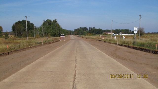
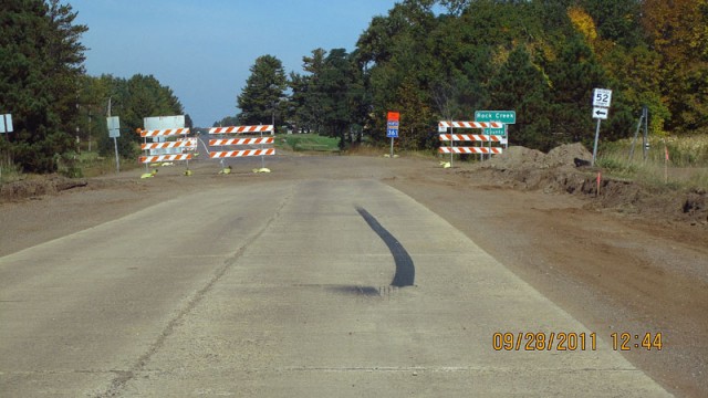
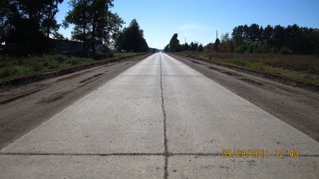
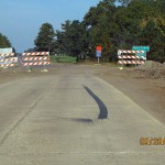
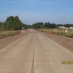
Jeff Wulke was kind enough to share the following photos of what is now Chisago County Road 30 (former MN 361, U.S. 61) between Rush City and Pine Creek, where crews have temporarily stripped away the asphalt to reveal the historic original concrete pavement from the 1920’s!! The concrete was poured back in 1927 as part of the first paved highway between the Twin Cities and Duluth, and was covered when the road was widened and rebuilt in 1954. As you can see from the photos, the old road is in remarkably good condition. This stretch was recently turned back to county authorities after remaining under state jurisdiction as State Highway 361 for many years after I-35 was built to fulfill a legal obligation dating back to 1921 to have a trunk highway passing through the city limits of Rush City, which has since been expanded to encompass I-35. Many thanks again to Jeff for the photos!!
Tag: U.S. 61
North Shore Madness!!
Over the last month, I’ve been adding photo-articles on the historic alignments and bridges along the North Shore Scenic Highway between Duluth and Little Marais to the U.S. 61 Project. In all, there are 22 new photo-articles to check out! The photos in the articles were taken in a two-day period back in April, 2010. See the links below:
- Old Highway 61 Between Illgen City and Little Marais
- Old Alignment at Illgen City
- Baptism River Bridge and Highway
- Old Highway at Palisade Head
- Beaver River Bridges
- Algoma Way
- Wood Ridge Drive
- Pine Bay Loop
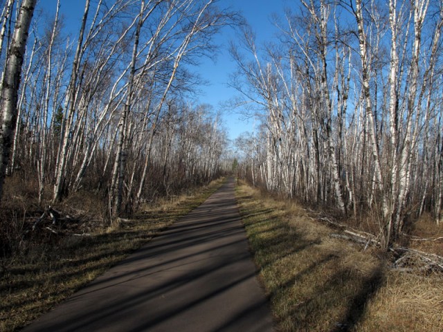
- Gitchi Gami Trail at Chapin’s Curve
- Split Rock Lighthouse Overlook
- Old Alignment at the Split Rock River
- Gitchi Gami Trail at Gooseberry State Park
- Gooseberry Falls Concourse
- Old Road at the Encampment River
- Gitchi Gami Trail at Silver Creek Cliff
- Stewart River Bridge
- French River Bridge
- Talmadge River Bridge
- Buchanan Historic Marker
- North Shore Scenic Drive
- Lester River Bridge
- Old Thompson Hill Overlook
Finally! The New U.S. 61 Interactive Map is DONE!!
After months of work and technical setbacks, I have finally finished the year-by-year data for the U.S. 61 interactive map. I have also cleaned up and updated the whole U.S. 61 section, wrapping the old historic alignment and roadside sections into one called “Articles“.
For those of you not familiar with the other “year-by-year” maps on the site, this data allows you to see the alignment and paving status of the road in any given year. Changes completed that year are also available for comparison so you can see which sections of road were bypassed or paved each year. A new feature I’ve added with this map is the “Compare-a-Year” feature, which allows you to add the alignment from another year. Finally, an “Articles” layer had been added that allows you to see the locations of all the U.S. 61 articles I’ve posted over the years.
U.S. 61 Page Update and New Articles
Just finished a major update to the U.S. 61 section of the page to bring it up the snuff with the new routes being added. I also threw in a couple of brand new articles on old alignments along the north shore for good measure (click on the sample photos below to see them).
Back in April I undertook my first “overnight” expedition, photographing old alignments along the north shore for two days, with a night out in Two Harbors in-between (watch out for those $1 PBR’s, they’ll kill ya!) I have a ton of photos and articles to add in the next couple of months, so rest assured, these two are just the tip of the iceberg!
The New Guide to Driving Old 61 Between the Twin Cities and Duluth
New Article: Westgate Boulevard, Duluth
I have just added another article to the U.S. 61 Project on Westgate Boulevard in Duluth. This was one of my favorite old alignments of U.S. 61 to visit, due to an unexpected marker dedicating its construction in 1924, plus the great views of Duluth Harbor and the pleasant walk through the woods it provided after a long drive. Click the photo below to check it out!
Two New U.S. 61 Articles
Two more articles on historic alignments of U.S. 61 just west of Duluth on the Thompson Hill have been added!
Old Hwy 61 and Thompson Hill Road
Old Hwy 61 at the Carlton/St. Louis County Line
Some new articles and photos for Christmas (a little late)
In the past week I have added several articles on old alignments of U.S. 61 between the Twin Cities and Duluth, all visited and photographed on two road trips I took in October and November. I have also done some updating of the U.S. 61 section, adding Google Maps API functionality to enable the display of a map showing every historic alignment of U.S. 61 in Minnesota. I have also added a downloadable KMZ file of the alignment map for Google Earth!
The new articles (from north to south):
Service Drive at Maki Road, Thompson Township
Old 61 Between Scanlon and Carlton
Market Street, Mahtowa
Rail Crossing Between Barnum and Mahtowa
Old Hwy 61 North of Barnum
Moose Lake Service Drive
Old Alignment South of Hinckley
Old Alignment at Rock Creek
North Service Drive at Rush City
Alger Avenue, Rush City
South Service Drive at Rush City
Frontage Avenue, Stacy
Historic Roadside Structures Along U.S. 61
I recently added a new section to the U.S. 61 Project: An overview and photographs of the historic roadside structures along modern U.S. 61 in Minnesota. Click the photo below to check it out!

New Images Galore!
Several new images have been added to the U.S. 61 Project, including:
New historic postcards!

Four new galleries of photos along modern U.S. 61!


