
Home >> Projects >> U.S. 61 >> Modern Highway Photo Galleries
 Modern Highway Photos: I-494 to Red Wing
March, 2007 (Page 3)
>> Jump to Page: 1 | 2 | 3 | 4 | 5 | 6
Southbound, approaching the south junction with U.S. 10 in Denmark Township,
just north of Hastings. On the right is a MnDOT material dump.

Direction signs to Hastings and Prescott, just before the junction with U.S.
10.
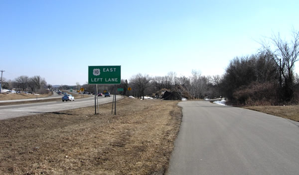
At the turn lane for U.S. 10 - eastbound to Prescott, Wisconsin.

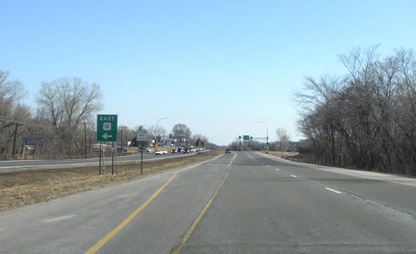
At the actual south junction with U.S. 10. This intersection was constructed
in 1981 just to the north of the original junction.

A close-up of the route signage at the junction with U.S. 10. U.S. 61's marker
looks a bit lonely after the split with U.S. 10.
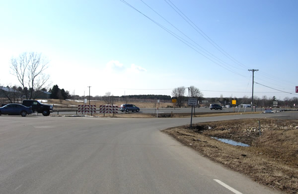
Looking west on 127th Street, the old alignment of U.S. 10, towards the site
of the old south junction with U.S. 61, used from 1935 until 1981. The road
to Prescott was originally marked as State Highway 94 when it was added to
the trunk highway system in 1934. U.S. 10 replaced it the following year after
being given a new route through western Wisconsin.

At the Hastings city limits, approaching the bridge over the Mississippi River
after descending the hill from U.S. 10 into the river bottoms. The divided
highway and bridges here date back to about 1979.

At the north end of bridge #5895 over the Mississippi River at Hastings. The
bridge was completed in 1951, replacing the historic spiral bridge. This bridge
will be replaced in 2010 due to its poor condition and fracture-critical design
(note the weight-limit sign on the far right).

Entering Hastings at the south end of the bridge 5895, looking south down
Vermillion Street, which has carried U.S. 61 since it was first marked in
1926. Vermillion Street has been a divided highway since 1927. The Hastings
City Hall, formerly the Dakota County Courthouse, is visible on the far left.
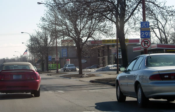
Further south in Hastings, southbound at the junction with State Highway 291
at 18th Street. Highway 291 was authorized in 1951 as the route to the Minnesota
Veterans Home. It was moved south from its original alignment on 10th Street
to 18th Street in 1970.

On the south side of Hastings at the north junction with Highway 316. Highway
316 was authorized in 1959 to provide a short-cut between Hastings and Red
Wing, cutting the corner of U.S. 61's right-angle route through Miesville.
Notice how Highway 316 carries the National Great River Road (see the sign
on the far right). The divided highway south of the Vermillion River was completed
in 1983.
>> Next Page
>> Page Index
- Page 1 - New Freeway and Interchange with I-494 at Newport
- Page 2 - Cottage Grove and the Jct. with State Hwy. 95
- Page 3 - Jct. with U.S. 10 to the North Jct. with Hwy. 316 at Hastings
- Page 4 - Southern Dakota County
- Page 5 - Eastern Goodhue County and the Cannon River Valley
- Page 6 - Red Wing
>> Back to the Photo Gallery Index
>> back to top