

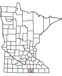
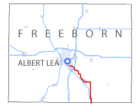
 Old Jefferson Highway - Iowa State Line to Albert Lea
Old Jefferson Highway - Iowa State Line to Albert Lea
Part Of:
U.S. 65 first marked in late 1926.
Historic Context: State-Aid road used as a temporary trunk highway until the completion of the permanent highway in 1930.
Length: 13.5 miles (1924)
In Use: Right-of-way finalized in 1923, majority in use before 1921.
Construction: Graded and graveled as State Aid Road 4 by Freeborn county through 1921, except for northernmost 0.3 miles which was graded in 1923 by the MHD as part of a new entrance to Albert Lea.
Bypassed: 1929-1930 by construction of the first modern trunk highway (along modern U.S. 65).
Status: About 9.5 miles rebuilt and paved as county roads. About 4 miles along County Roads 106 and 81 maintained in original unpaved condition.
Visited: August 2011, July 2010.
Tour Navigation
Tour Map

Click on a rectangle to jump to an inset
Jump to...
Related Articles

The old path of the Jefferson Highway between the Iowa state line and Albert Lea zig-zags its way north along what are now a string of county roads to the east of modern U.S. Highway 65. Although most of the route has been paved and modernized, a few peeks of the road as it once was still remain.
Overview
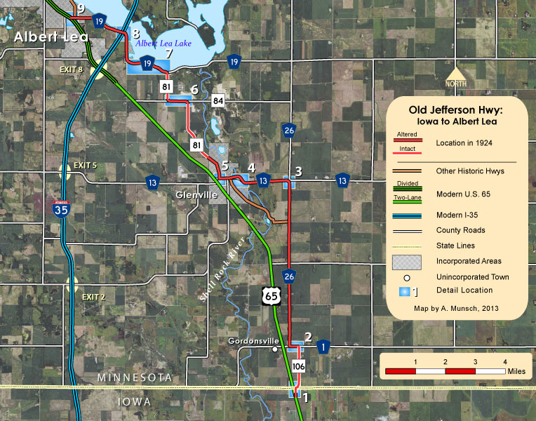
This tour follows the road as it was In 1924; by that time the entire road was still gravel and generally followed section-line roads or natural features such as the Shell Rock River and Albert Lea Lake. The road passed directly through downtown Glenville, but bypassed the small unincorporated village of Gordonsville. The road was replaced by the construction of the permanent highway along modern U.S. 65 between 1929 and 1930, which was built to parallel the Chicago, Rock Island, and Pacific Railroad, cutting nearly 2.5 miles off the trip, eliminating many sharp curves, and bypassing downtown Glenville.
In the years after being bypassed the old route was broken up into several county roads and is now marked as part of 7 different routes in only 13 miles, most of which have since been rebuilt and paved. The exceptions are along County Roads 106 and 81, which are still (presumably) in original unpaved condition.
We begin the tour at the south end, where the old road crosses the Minnesota / Iowa state line just east of modern U.S. 65....
1: At the State Line
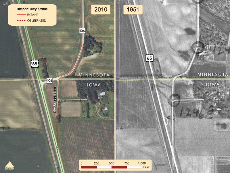
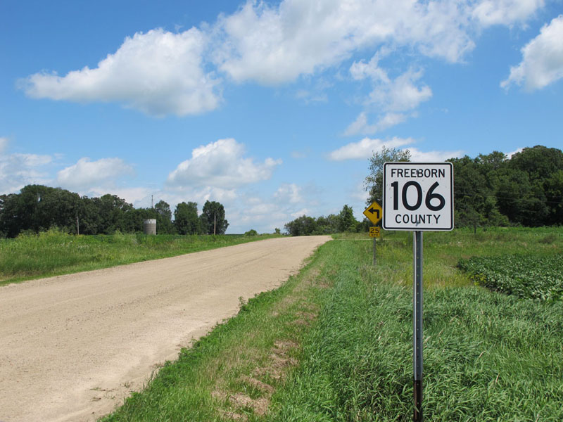
The old route once met the current highway in Iowa, just south of the state line. This intersection was removed at some point in the 1950's or 60' and replaced by a new connection at the state line (now the south end of County Road 106). The south end of old road became a dead end, and is now marked as "Mockingbird Lane" and provides access to one homestead. Both Mockingbird Lane and County Road 106 north of the border remain unpaved and much as they were in the 1920's.
Looking east on County Road 106 from U.S. 65 towards Mockingbird Lane.
Looking back to the southwest down Mockingbird Lane at the old state line crossing. Modern U.S. 65 can be seen in the background.

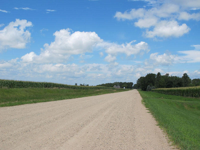
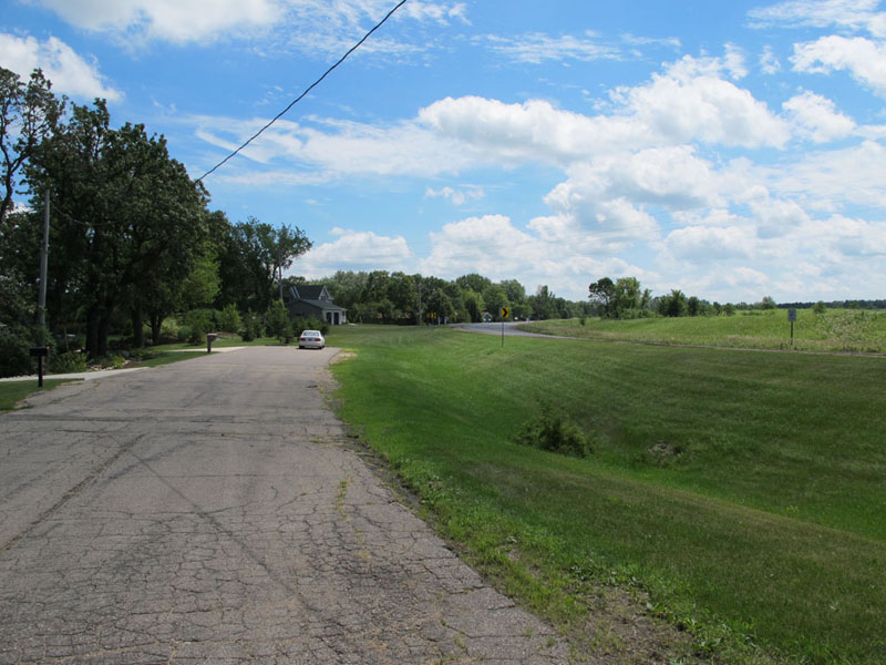
County Road 106 as it winds its way into the farmland of southern Minnesota. This section of the road appears to have been maintained in its original condition. It remains this way for about a mile until it runs into County Road 1.
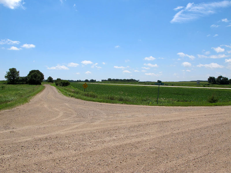
2: Turns At Gordonsville

The old highway followed County Road 106 north from the border for about a mile to what is now County Road 1 east of Gordonsville. The road then turned west and followed County Road 1 for a quarter-mile to County Road 26, where a very shallow curve directed traffic to the north . The curve is now gone, and County Roads 1 and 26 have been widened and paved.

Looking northwest from County Road 106 the junction with County Road 1 towards Gordonsville. The old route turned left here.

On County Road 1, looking west towards Gordonsville.

The junction with County Road 26, where the route once turned right.
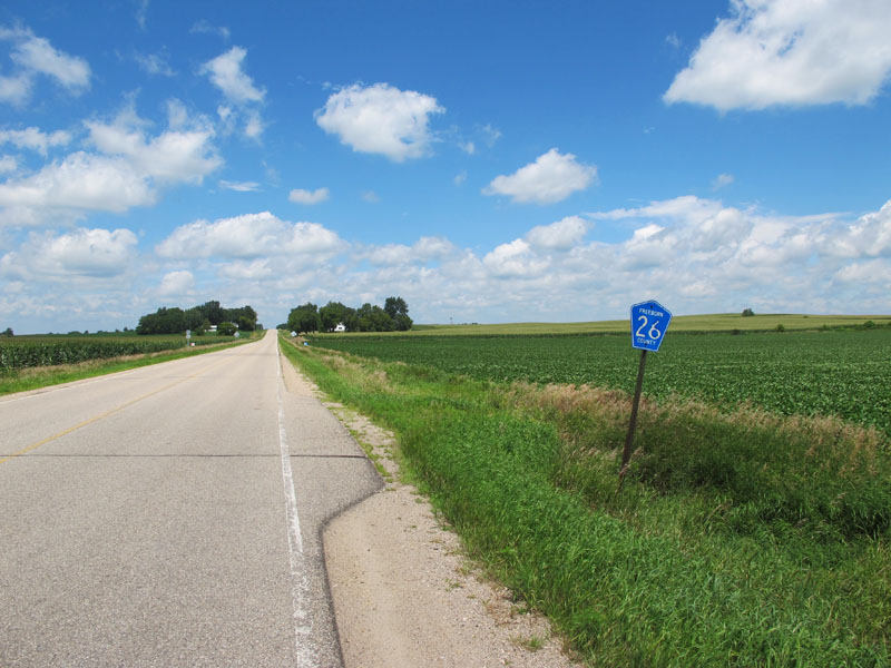
Northbound on County Road 26 after turning right. The old route followed County Road 26 north for four miles to County Road 13.

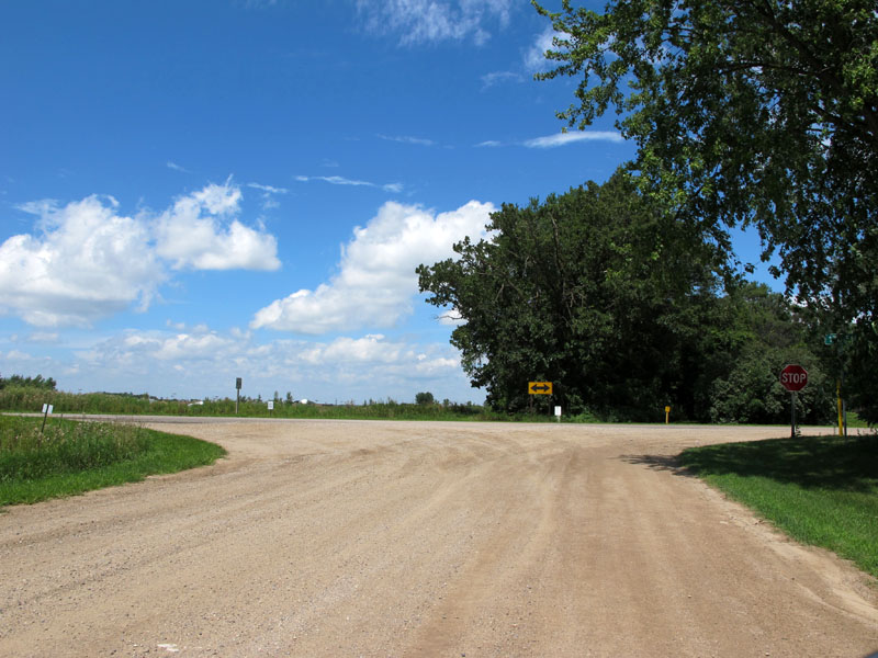
Intersection with "River Road" (left) and 140th Street (right)
, 3 miles north of County Road 1. "River Road" was the early route of the Jefferson Highway into Glenville.
 Turn Left onto Old Jefferson Highway: River Road at Glenville
3: Junction of County Roads 26 & 13 East of Glenville
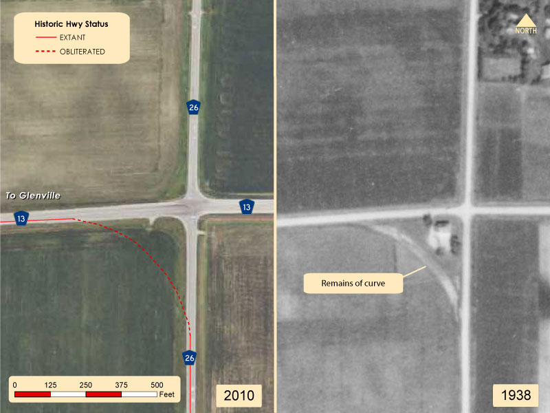
At County Road 13 the old road curved to the west (left) towards Glenville. The 1938 aerial image (above, right) shows that the curve had already been abandoned by 1938. All trace of it has since been erased (also note the disappearance of both the farmstead to the north and the building at the junction).

Northbound at the junction with County Road 13. Note the sign ahead pointing the way to Glenville.

Westbound on County Road 13 towards Glenville.
4: Shell Rock River Approach At Glenville

After traveling a mile to the west along County Road 13, the road curved to the north as it approached the Shell Rock River and Glenville. The bridge over the river in 1924 was a concrete-deck girder bridge designed by the Minnesota Highway Department, and built in 1921. The approach to the river was moved south at some point between 1954 and 1962. However, a portion of the original curve was left behind as a local street, now "Shell Rock Lane". After crossing the river, the road entered downtown Glenville.

County Road 13 westbound as it makes its way into Glenville. The old road in use in the 1920's (Shellrock Lane) is on the right.

Shell Rock Lane ends at
the road to Glenville Beach. It originally continued ahead through the bushes.
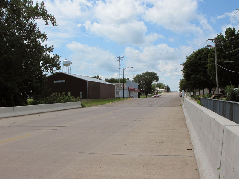
Looking west into downtown Glenville on the current bridge over the Shell Rock River.
5: Turn At Glenville

After passing down Main Street in Glenville, the old route made a turn to the north towards Albert Lea at 3rd Avenue, now County Road 81. The junction with County Road 81 is not marked, and is easy to miss. After exiting Glenville, County Road 81 reverts to a gravel road and continues north for about two miles to County Road 84.

View to the west on Main Street in sleepy downtown Glenville.

Looking west on Main Street (Co Rd 13) at 3rd Avenue in Glenville. The old route made a hard turn to the right here onto what is now County Road 81. The junction with the
county road is unmarked, making it easy to miss.
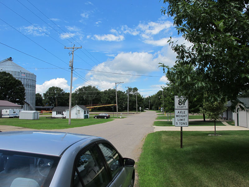
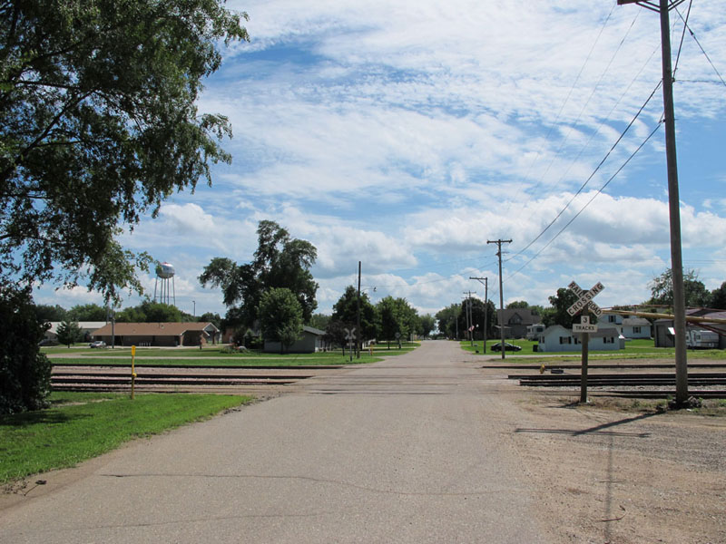
Looking north on 3rd Avenue / County Road 81 from Main Street towards an at-grade rail crossing.
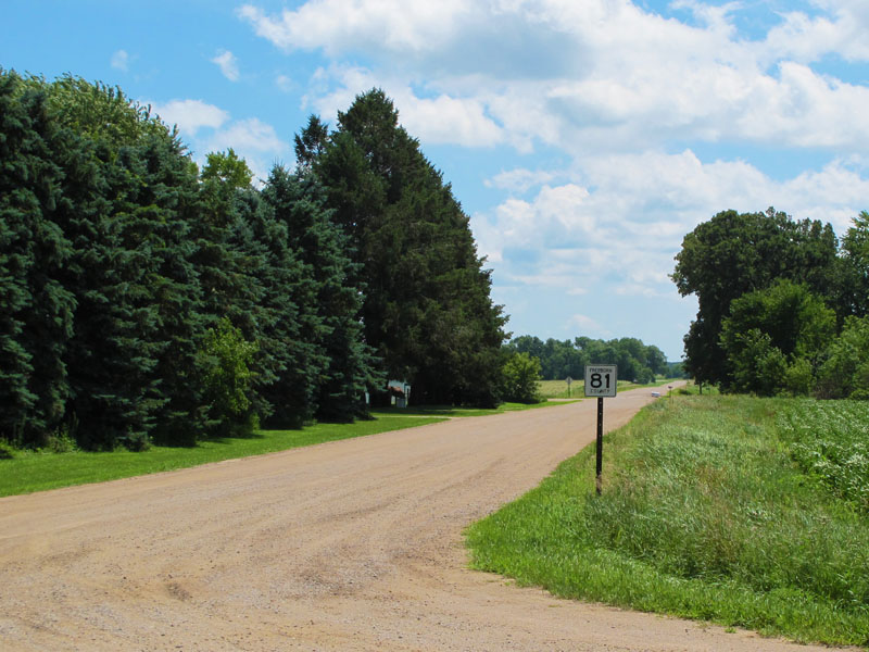
At the Glenville city limits the pavement gives way to gravel. The road past this point is much as it was in 1924.
Scene on County Road 81 north of Glenville.
County Road 81 northbound, approaching the junction with County Road 84.
6: Junction of County Roads 81 and 84

The junction of County Roads 81 and 84 is now a set of T-intersections separated by about a half-mile. When this was the main highway, the roadway was continuous and used a set of curves to navigate the half-mile jog to the west. The western curve was removed sometime in the mid 1960's, while the east curve was removed in the 1980's. The east-west oriented section on County Road 84 has been rebuilt and paved, while the sections on County Road 81 remain gravel.
Looking north at the junction with County Road 84.

Westbound on County Road 84 after turning left. County Road 84 follows the path of the old highway for about a mile.

At the west junction with County Road 81, looking west. The old road curved to the north here. The curve was removed in the 1960's.

Northbound on County Road 81 after turning off of County Road 84.
7: Road Along the South Shore of Albert Lea Lake
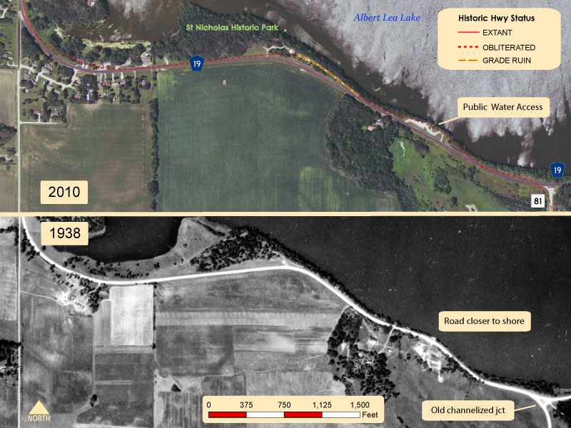
County Road 81 ends at the junction with County Road 19 after traveling north for about a mile. The old road once curved to the left (west) onto County Road 19 and then proceeded along the south shore of Albert Lea Lake. At some point between 1954 and 1962 County Road 19 was rebuilt, moving the roadway further from the lake shore and straightening out some of the curves. A boat landing now occupies part of the old right-of-way, while a nearly hidden remnant of the old road grade survives on the north side of County Road 19 between the boat landing and the entrance to St Nicholas Historic Park.

Looking north on County Road 81 at the junction with County Road 19. The junction has been much simplified since the 1930's.
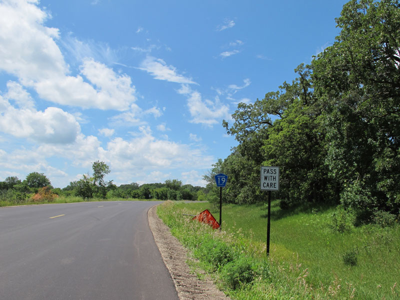
Westbound on County Road 19, which was in the process of being repaved in 2010.

Driving by the boat-landing (right) located on the former right-of-way of the old highway.

The entrance to the old grade ruin is a bit past the boat landing (behind the car, photo looking westbound).
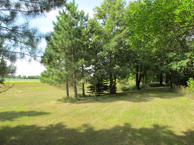
Inside the grove of trees on the old road grade, which is kept mowed.
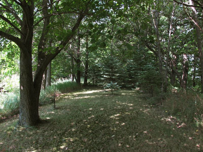
A bit further into the grove, where a planting of pine trees has blocked the old road.
8: Curve at the I-35 Overpass
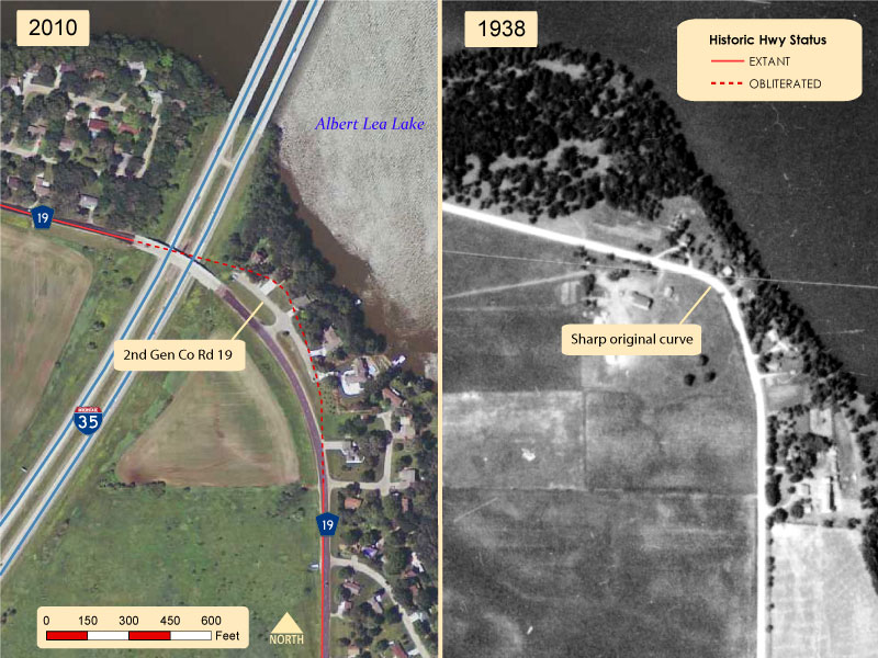
County Road 19 eventually crosses over I-35 as it approaches the outskirts of Albert Lea. Just south of the overpass is a short section of old county road, now a residential service drive. It is tempting to think that its part of the original road, but it is in fact the second generation road, built at some point in the 50's or 60's as part of development in the area. It was bypassed when I-35 was built in the early 1970's. The curve on the original road was even closer to the lake, and has since been destroyed.

On Old County Road 19, looking northwest towards the bridge over I-35. This section of road is not the old highway, but a second-generation road that replaced it in the 1950's. The county road was realigned again in the early 1970's by the construction of I-35.
9: Junction with U.S. 65 at Albert Lea

The north end of the old highway is the junction of County Road 19 with U.S. 65 on the south side of Albert Lea. This area was once much more rural, but has since filled in with various types of development. U.S. 65 at the site has been expanded to four-lanes, and the junction of the old road with the modern highway has been realigned to meet it at a right-angle. The section of the road west of Frank Hall Drive became part of State Route 1 in 1923 after it was rebuilt as a new entrance highway to Albert Lea (Frank Hall Dr was the old route).
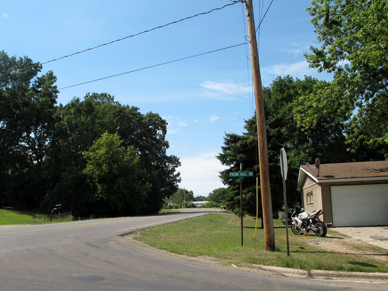
The end of the line: on County Road 19 as it approaches modern U.S. 65 on the south side of Albert Lea, looking west from Frank Hall Drive. Frank Hall Drive was the previous route of the Jefferson Highway into Albert Lea before 1923, when the road ahead was graded to connect directly to Broadway.
 Turn Right onto Old Jefferson Highway - Frank Hall Drive and 4th Street in Albert Lea
More Photos (southbound and odds and ends)

The junction with County Road 19 (the old route) from U.S. 65 southbound.
Southbound view of old County Road 19 alongside the current road, just south of the I-35 overpass.

The rustic entrance sign at St Nicholas Historic Park on the south shore of Albert Lea Lake, looking southeast. County Road 19 is on the far right.

Glenville 1st Lutheran Cemetery at the west junction of County Roads 81 and 84, looking southwest.

Curiously, the concurrence of County Roads 84 and 81 is only marked in the eastbound direction (photo looking southeast).

Eastbound on County Road 84, approaching the junction with County Road 81 (the final turn towards Glenville).
Looking south down County Road 81 towards Glenville from the junction with County Road 84.

View to the south on County Road 81 on the north side of Glenville, with the grain elevators of Glenville towering in the distance.
A closer view of the old grade crossing in Glenville, looking south. Although this crossing was bypassed by the new highway in 1930, it was only replaced with another crossing of the same type, which is still there today (although reduced to one track).

Looking back to the east down Main Street from 3rd Avenue in Glenville.

View to the north at the Shell Rock River in Glenville, showing the old Illinois Central bridge.

Looking north from Shellrock Lane up the road to Glenville Beach (not the old highway), showing the old Illinois Central rail overpass.

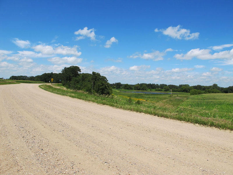
A view to the south on County Road 106, about a mile north of the border.
>> Back to Historic Highway Tours
Sources
- Minnesota Highway Department. Construction Plan For Trunk Highway No. 65-1 Between So. State Line and Albert Lea (State Proj. No. 65-1-53). Approved 1929.
- Minnesota Highway Department. Construction Project Log Record: Control Section 2404.
- Minnesota Highway Department. Right-of-Way Map: Freeborn County, Between S. State Line and Albert Lea. Index # 0-25.
- National Aerial Photography Program (NAPP) 1991 Aerial Photos.
- U.S. Department of Agriculture. Various Aerial Photos and/or Indexes for 1938, 1949, 1954, 1962, and 1968.
- U.S. Department of the Interior Geological Survey. Aerial Photos From the Minnesota Statewide Collection 1951.
- U.S. Department of the Interior Geological Survey. Albert Lea Quadrangle, Minnesota 15 Minute Series (Topographic). 1954.
- U.S. Department of the Interior Geological Survey. Glenville Quadrangle, Minnesota-Freeborn County Co. 7.5 Minute Series (Topographic). 1982.