
 |
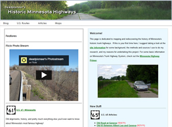
Deadpioneer's Historic Minnesota Highways (https://deadpioneer.com)
A page dedicated to the mapping and rediscovering the history of Minnesota's historic trunk highways. Independently researched, created, and developed using HTML, CSS, Javascript, the Google Maps API, and Google Fusion Tables. Construction of the site required working knowledge of the following software:
|
Interactive Map Example: Historic U.S. 61, Minnesota
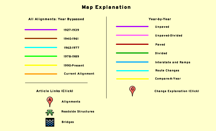
Map Layers
(Map key located below map window)
All Alignments
Shows all alignments of U.S. 61 in Minnesota, color-coded by year bypassed (turns "Year-by-Year", "Route Changes" and "Compare-a-Year" features off).
Year-by-Year
Alignment of U.S. 61 on January 1st of a given year. Click "route changes" to see changes in alignment or paving status completed in a given year.
Compare-a-Year
Adds a partially transparent line of a given year's alignment for comparison to any other layer.
Articles
Articles on historic alignments, roadsides, and other subjects. (Also accessible in the Articles section).
Zoom-To
Alignment data up to date as of May 28, 2011
Map Notes
Historic information was taken from MnDOT construction logs, highway plans, right-of-way maps, official highway maps, historic aerial photos, and a few other sources.
Alignment lines were drawn using Google Earth. The map is powered by the Google Maps API. The "All Alignments" data uses Google Fusion Tables.
All alignment lines are drawn to match up with the default aerial imagery used by Google Maps/Earth. Google updates the imagery from time to time - at which point I edit the alignment data if necessary (there may be a delay between when the imagery is updated and when the alignment data is updated).
I have tried to make the alignment lines as accurate as possible. This is done by overlaying old highway plans and aerial photos over the current imagery in Google Earth, and tracing the old roads on the plans. Any errors on the plans will therefore end up on the finished lines, so some of the alignments should be taken with a grain of salt, especially anything bypassed in the 1920's or 30's.