
 Historic U.S. 61: Old Alignment at the Split Rock River
Old Alignment at the Split Rock River
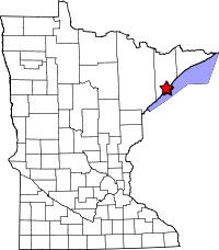
Located: Along the east side of State Highway 61, from a point 1/3 of a mile south of the Split Rock River,to a point 0.8 miles north, in Split Rock Lighthouse State Park, Silver Creek and Beaver Bay Townships, Lake County.
Historic Context: Part of the original North Shore Scenic Highway constructed in the 1920's.
Length: Approx. 1 mile
Constructed: 1924
Bypassed: 1959, by construction of a new alignment.
Also Part Of:
Status: 0.85 miles rebuilt into a paved recreation trail, 0.1 miles of unpaved ruin.
Access: Public, no motorized vehicles. Best accessed by bike from a public parking area on the west side of the highway on the south side of the Split Rock River.
Old Split Rock River Bridge
Bridge #: 3583
Design: Deck truss, 80 foot span.
Constructed: 1924.
Historic Context: Steel truss bridge built for the first north shore scenic highway.
Status: Lost. Replaced by a foot bridge. Some sections of the old footings may still exist.
More U.S. 61 Articles
North >> Split Rock Lighthouse Overlook
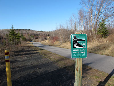
A section of the Gitchi Gami Trail at the Split Rock River reuses parts of the original north shore scenic highway.
Originally constructed in 1924, the old highway was bypassed way back in 1959 by construction of a new alignment a bit further from Lake Superior. Included in the construction was a culvert over the river, which replaced the original deck truss bridge. After being bypassed the old bridge was closed with permanent barricades.
Surviving sections of the old highway were left behind on either side of the old bridge as local roads (the road south of the river was made up mostly of a temporary connection built during the project, see plan below). Eventually, the old bridge was removed and the two roads fell into disuse (as seen in 1991 and 2003 aerial photos).
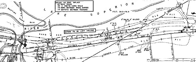
Plan showing
the location of the temporary bypass built in 1959
The old highway finally found new life in the mid 00's, when the DNR used the surviving portions for construction of the Gitchi Gami Trail. A new footbridge was built on the site of the old highway crossing, allowing cyclists and pedestrians to enjoy the view of the mouth of the Split Rock River once seen by motorists.
Map
Key
- Blue = Repurposed/rebuilt into the Gitchi Gami Trail.
- Red = Ruin
- Orange = Lost alignment, removed.
- Yellow = Ruin of old temporary bypass / service drive
- Olive = Gitchi Gami Trail on new alignment
Photos - taken in April, 2010.
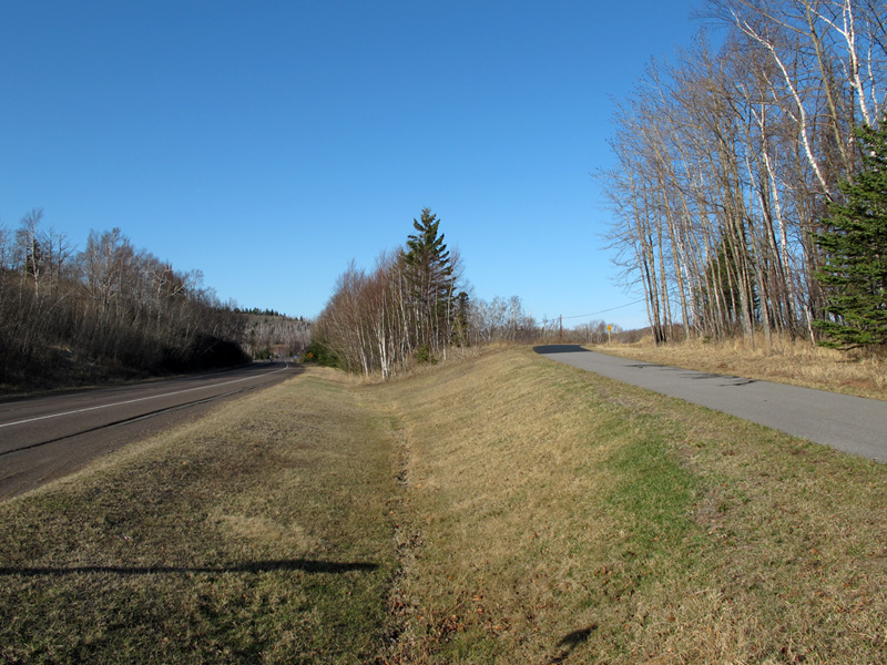
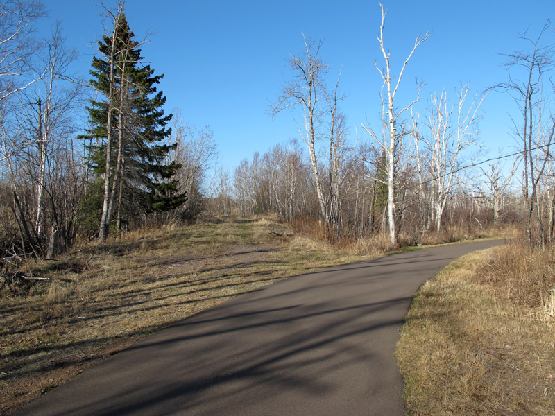
Looking north from the ditch between Highway 61 and the Gitchi Gami Trail about a third of a mile south of the Split Rock River. The trail enters the old road grade at the top of the small hill ahead where the tree line between the road and trail starts.
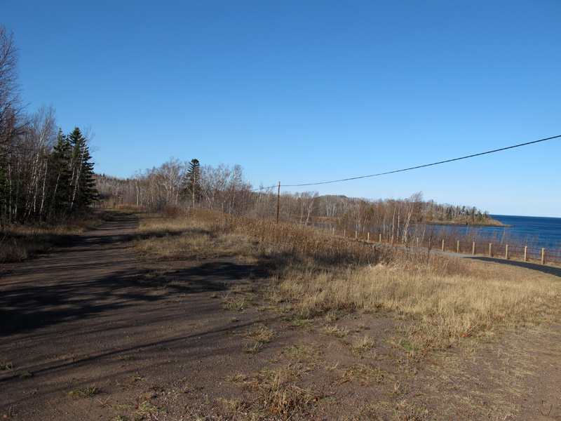
At the top of the short hill, where the trail leaves the old highway to take advantage of a better view of Lake Superior (this was once the site of a gravel pit). A ruined portion of the old highway bypassed by the trail can be seen on the left.
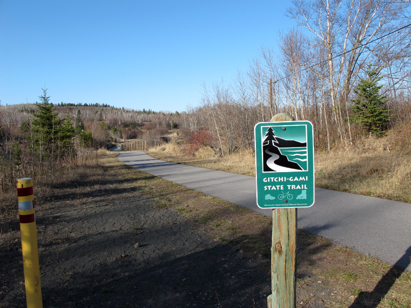
A Gitchi Gami Trail marker. On the left you can see the ruin of what is actually a temporary connection built during the 1959 construction at the point where it merges with the trail.
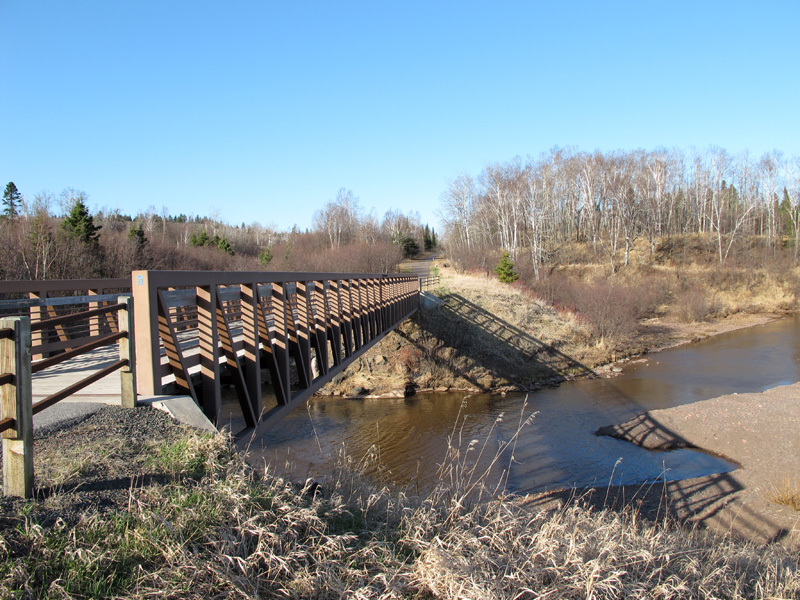
Looking north across the Split Rock River at the new trail bridge, built where the old deck truss bridge used to be. One of the old footings is visible on the opposite bank.
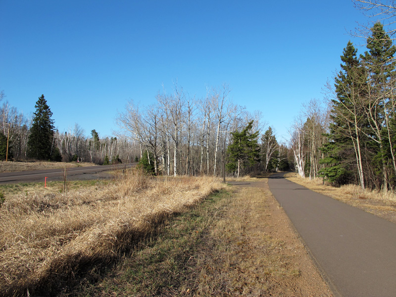
Further along the trail, where it curves away from the current highway. The entrance on the left was used when the old highway was a local road.
The north end of the section of the trail that uses the old highway grade. On the left you can see the ruin of the old road where it once continued to connect to Highway 61. The trail on the right continues into Split Rock Lighthouse State Park.
Sources
- Construction Project Log - Control Section 3806
- Construction Plan, S.P. 61=1-01, June, 1923.
- Construction Plan, S.P. 3806-17, 5-1-1958.
- Construction Plan, Bridge #3583, 10-12-1923.