
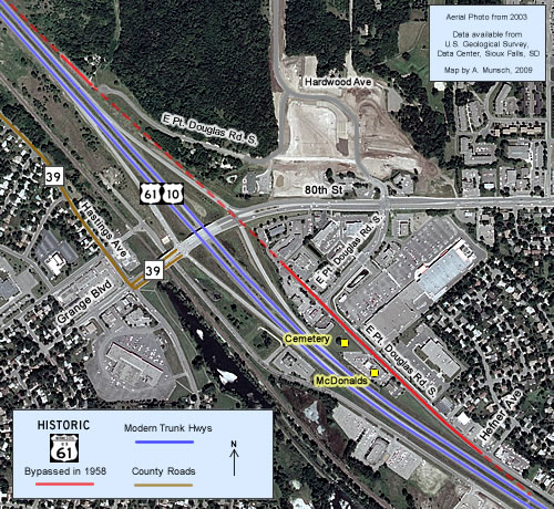
 Historic U.S. 61: Point Douglas Road, Cottage Grove (At 80th St)
Point Douglas Road (At 80th St)
Located In: City of Cottage Grove, Washington County.
Bypassed: 1958
Length: 1.22 miles
Also Marked As:
 1935-1958
 Until 1934
A short section of Point Douglas Road south of 80th Street in Cottage Grove still uses the alignment of the original paved highway between St. Paul and Hastings. The surviving section was once part of a much longer service drive that stretched from Hefner Avenue on the south, to almost a half mile past 80th Street on the north.
Construction
The surviving stretch of the alignment was originally paved with 18 feet of concrete. The section north of 80th Street was completed in 1925; the section to the south was completed in 1927.
Bypass History
The original road was replaced in 1958 when U.S. 61/10 through Cottage Grove was upgraded into a divided highway.
Current Status
There were nothing but farms and a cemetery along the service drive in 1958. Over the next 50 years the area was transformed into a busy retail district.
A 1964 aerial photo shows that the service drive was extended south as part of nearby residential development. The original concrete pavement was also eventually paved over.
In 1983 MnDOT constructed the 80th Street/Grange Boulevard interchange. Roughly half of the service drive was demolished to make room. Only a tiny section survived at the very northern end (this section is now either inaccessible or gone due to the construction of White Pine Senior Living of Cottage Grove). The remaining section south of 80th Street was capped with a cul-de-sac.
Today, only the cemetery remains as a reminder of the area's rural roots. The old road has been extensively rebuilt and widened to handle the increased traffic.
Photo Tour - All photos taken in March, 2007.
North of 80th Street
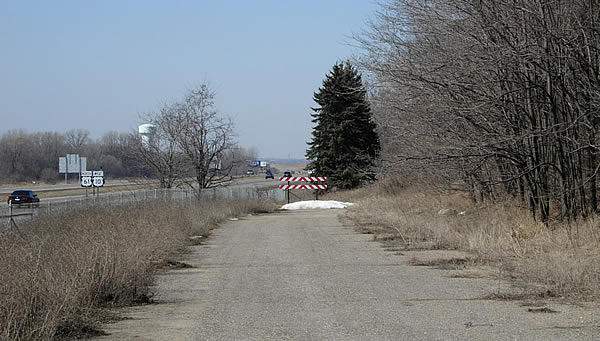
Looking north at the northern end of E Point Douglas Road. This tiny section
of the old highway was paved over in 1958 to serve as the entrance to the
main highway at the north end of the former service drive. Note the route markers on the left.
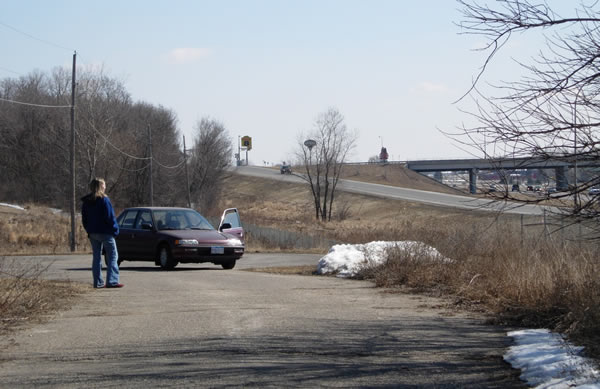
Looking south toward the 80th Street interchange, which wiped
out the connection to the rest of the old alignment in 1983. Note the alignment
of the utility poles.The cul-de-sac at the end of E. Pt. Douglas Road marks
where a temporary intersection and traffic signal were constructed to serve
as a bypass of the main highway while the interchange was under construction. The cul-de-sac is now gone, removed to make way for the construction of a senior living center.
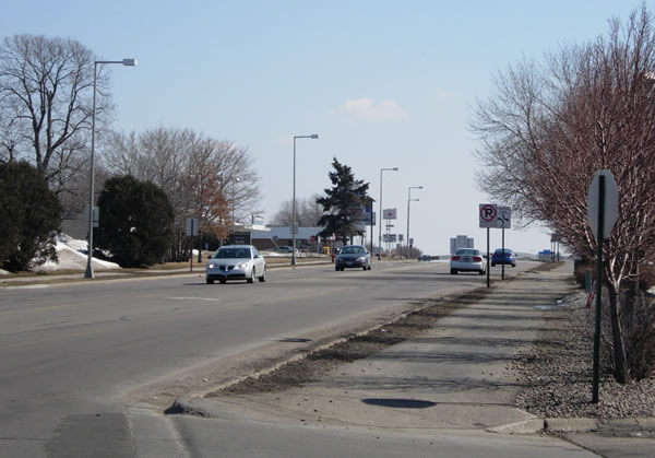
South of 80th Street
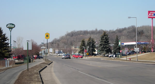
Looking north from the McDonalds parking lot down E. Pt. Douglas Road. This
section of the old highway was fully reconstructed after 1983 to serve the
now busy commercial area around 80th Street, erasing all signs that this was
the original alignment of U.S. 61.
Looking south from the the McDonalds parking lot down E Pt. Douglas Road.
The old highway continued straight ahead in the distance onto the alignment
of the modern road.
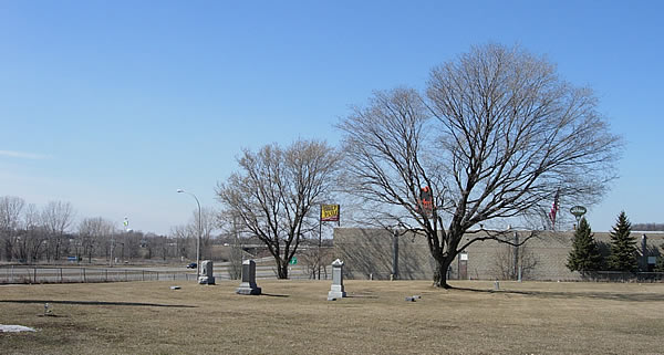
The rural cemetery, as seen (ironically) from the McDonalds parking lot.