
 Historic U.S. 61: Buchanan Historic Marker
Buchanan Historic Marker
Located: Just south of Knife River on St Louis County Road 61.

Constructed: 1939
Historic Context: 1930's Roadside development structure.
Status: Open to the public, in poor condition , but otherwise intact. being restored (as seen in aerial photos from August, 2010.)
Access: South side of St Louis County Road 61, wide shoulder provides a location for parking.
More U.S. 61 Articles
North >> Stewart River Bridge
South >> French River Bridge

The Buchanan Historic Marker near Knife River is a classic example of a masonry roadside structure constructed by the Department of Highways in the 1930's. It was designed by Arthur Nichols, who designed most of the early roadside structures for the highway department. It was most likely built in 1939 as part of a roadside development project in cooperation of the National Park Service.
The site, which seems to be intact and built to plan, includes an overlook wall, two benches, and a historic plaque marking the location of the town of Buchanan, the site of an early land office in northeastern Minnesota that only lasted a few years before disappearing into history.
Removed from the jurisdiction of the Highway Department in 1965, the site has fallen into a state of disrepair. However, aerial photos from August 2010 (from google maps) show what appears to be restoration work taking place.
Map
Photos - taken in April, 2010.
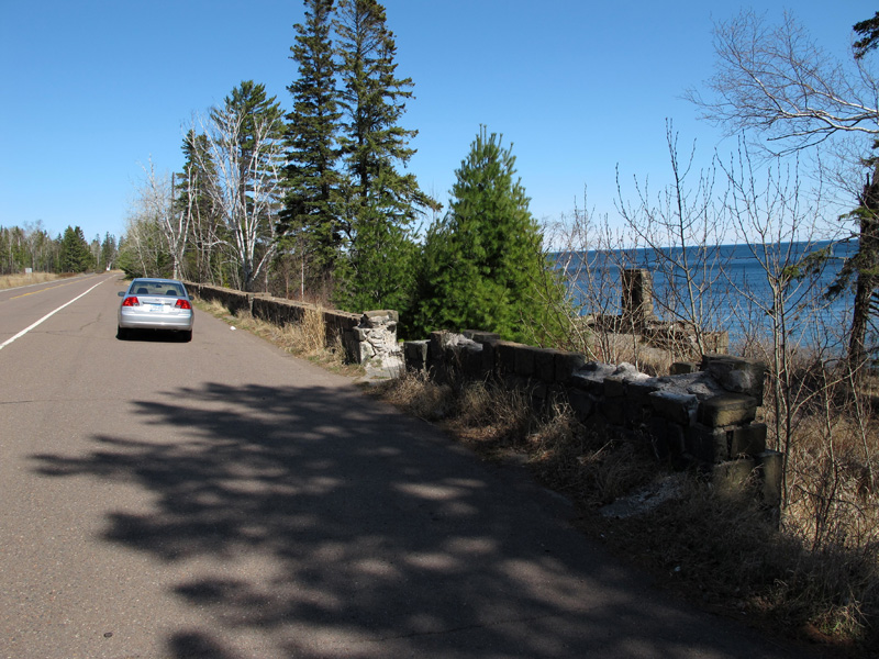
View of the wide shoulder that provides the only parking for the old roadside.
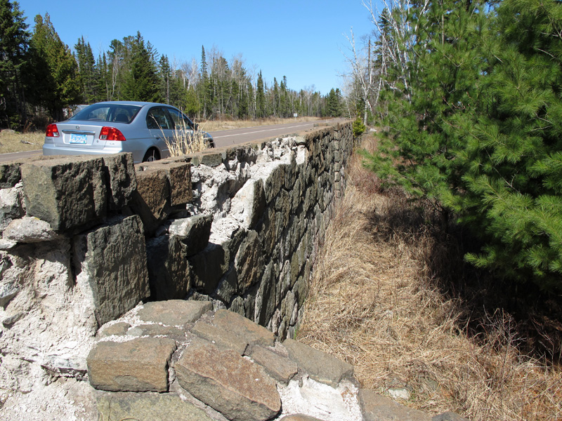
A close-up of the stone wall along the highway, showing its poor condition.
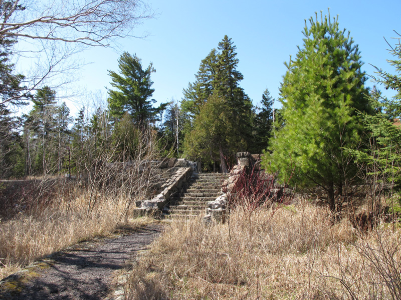
The stone stairs leading from the highway to the historic marker at the north end of the site (a second set
is located at the south end).
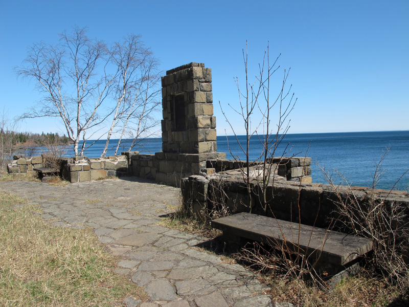
The viewing bay, marker, and benches.
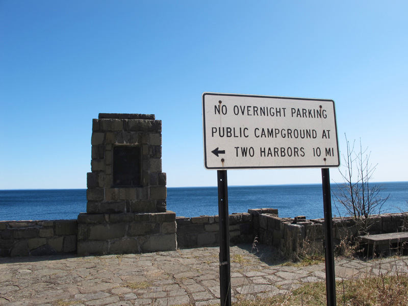
A modern sign at the marker, warning off prospective long-term visitors.
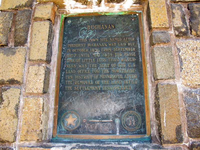
The text of the historic marker. Note the symbol of the old Minnesota Department of Highways in the lower-left.

Back-side of the marker wall.
Sources
- Construction Plan - S.P. 6926-01 - Lakeshore Wayside Historical Monument, 9/23/1936, revised 3/4/1937.
- MnDOT Construction Project Logs: Control Section 6926