Old Alignments of Highway 50 near Hampton
Bypassed: 1926
Marked As: ![]() 1921-1926
1921-1926
History
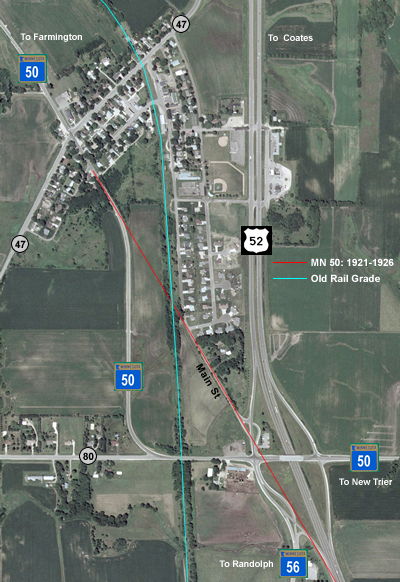
When Highway 50 was first marked in 1921, it was the only trunk highway through the tiny town of Hampton in south-central Dakota County. Highway 50 was routed onto what old plat maps called the "Dubuque-St. Paul Road". The old gravel road cut a straight diagonal through town with no regard to the placement of the railroad tracks, resulting in three at-grade rail crossings in 2 and a half miles. The first modern grade, constructed In 1926, was designed to correct this. The new grade was aligned to stay west of the railroad tracks north of town, use the original alignment through town, and then curve south of Hampton to an underpass, thus eliminating all at-grade crossings. Highway 50 still uses this grade today. The railroad tracks have since been abandoned and removed, and the bridge over the highway south of town demolished. The majority of the old St. Paul-Dubuque road bypassed in the 1926 construction was abandoned and recultivated. Only a small portion, now the southern end of Main Street, survives just northwest of the modern interchange of US 52 with State Highways 50 and 56 (see aerial photo, right).
|
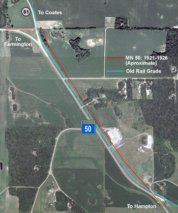
North of Hampton (see aerial photo, left), the old road crossed the railroad tracks just north of the water treatment plant, and then ran roughly parallel with them until curving sharply, crossing them again just east of County Road 81. 1937 aerial photographs of the area appear to show the scars of the old road. There is no sign left today, although one of the connecting roads between modern Highway 50 and County Road 81 runs along Highway 50's original alignment. Data available from U.S. Geological Survey, EROS Data Center, Sioux Falls, SD |
Photos
Photos from November, 2005 unless stated otherwise.
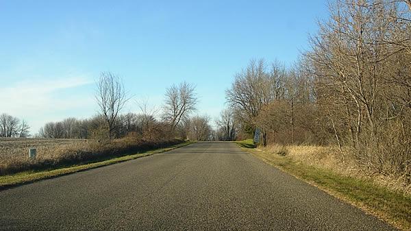
Looking north on Main Street, just northwest of the modern US 52/Highway 50
interchange on the southeast side of Hampton. This short stretch is the only
surviving portion of the original alignment bypassed in the 1926 construction.
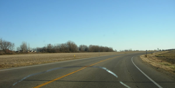
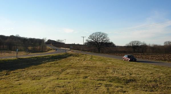
Looking southeast on modern Highway 50, south of County Road 47. The original
road continued straight ahead instead of curving, heading straight towards
the line of trees in the distance, which mark the old rail grade. The old
road was erased and the land recultivated.
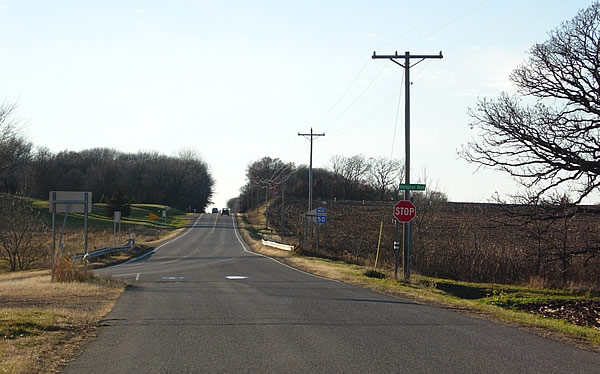
Above and below, more views of the old connecting road at County Road 81, built on the original alignment of Highway 50.