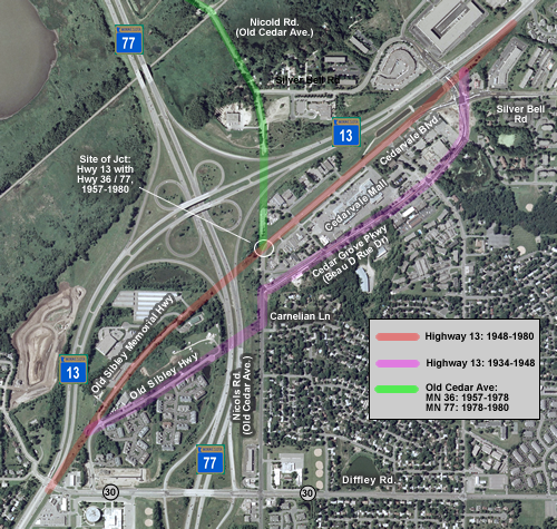
Old Alignments of Highway 13 Near Cedar Avenue, Eagan
Bypassed:
1948 - Old Sibley Highway, Nicols Road (part), Cedar Grove Parkway
(Beau D Rue Dr.)
1980 - Old Sibley Memorial Highway, Cedarvale Blvd
Marked As: 


History
Portions of two old alignments of State Highway 13 survive near Cedar Avenue (Highway 77) in Eagan. Highway 13's current alignment dates back to about 1980, when it was rebuilt between Diffley Road (Co Rd 30) and Silver Bell Road to facilitate an interchange with the Cedar Avenue Freeway. The previous alignment had been constructed in 1948 as part of a project to modernize Highway 13's route between Mendota and what was then US 65 (now I-35W). It was along this alignment that the Cedarvale Mall was constructed. The original alignment used from 1934 to 1948 had been further to the south along Beau D Rue Drive, and included a small jog on Old Cedar Avenue (now Nicols Road). When the Cedar Avenue Freeway was constructed, it cut across both old alignments, leaving disconnected sections on either side of the freeway. On the west side of Highway 77 the two old alignments serve an isolated neighborhood of town homes and a few businesses. On the east side of the freeway the old alignments run along either side of the old Cedarvale Mall, Eagan's first modern commercial area. The Cedarvale Mall area has been declining steadily since the 1980's. The one-two punch of the removal of direct highway access in 1980, and the construction of 35E in 1985, has left the mall almost totally vacant. The city of Eagan has recently undertaken a redevelopment program, which has included a total reconstruction of the intersection of Silver Bell Road with Cedarvale Boulevard to serve as a sort of gateway to the city. Various small housing developments have also been constructed. Controversy over eminent domain is currently delaying redevelopment of the mall area. |
 |
Photos
(Photos taken in: December 2005, August 2006, and December 2006.)
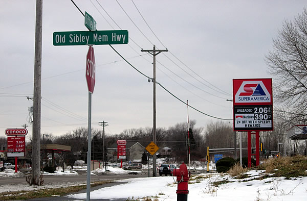
The old alignments on the west side of Cedar Avenue are accessible from Diffley
Road, just east of Highway 13. The "Old Sibley Mem Hwy" sign is
actually on an access road that is not part of the old highway. (This was
taken on Christmas of 2005. Look at those gas prices!)
 |
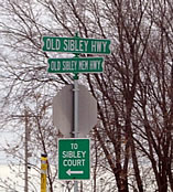 |
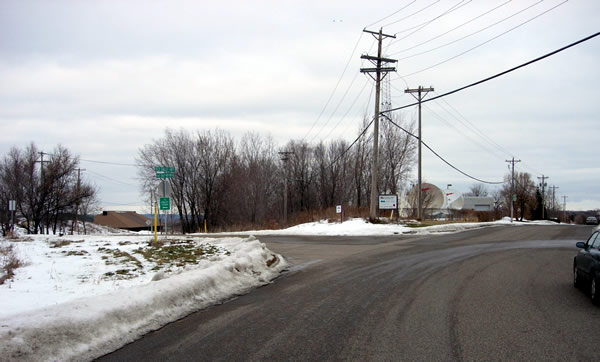
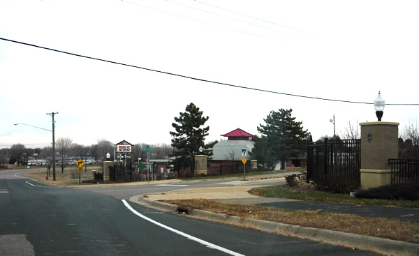
Above, The actual entrance to the two old alignments, just north and east of Diffley and Highway 13. The original alignment used from 1934 to 1948 is on the right, labeled as Old Sibley Hwy; the second alignment used between 1948 and 1980 is on the left, labeled as Old Sibley Memorial Hwy. At right is a close-up of the street signs.
Old Sibley Highway, Nicols Road, and Cedar Grove Parkway (Beau D Rue Dr.) - Bypassed in 1948
West of Cedar:
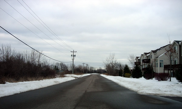
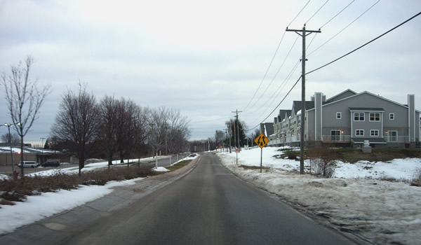
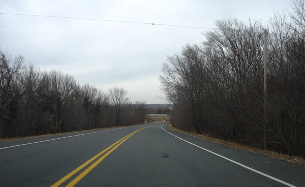
Looking northeast on Old Sibley Highway. Notice the new town homes on the
right.
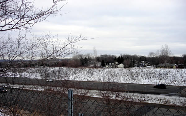
Looking east from the cul-de-sac at the end of Old Sibley Highway. The original
alignment is interrupted by the Cedar Avenue Freeway. Old Cedar Ave (now Nicols)
is visible on the other side. The road once continued across the site of the
freeway, meeting Nicols to the left of the white house in the center of the
photo.
East of Cedar:
Looking north on Nichols Rd (old Cedar Ave) at about the point where Highway
13 once came in from the west (left).
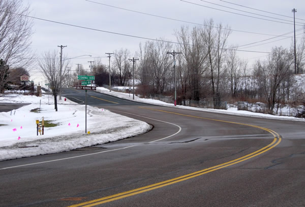
Looking north at the intersection of Nicols Road with Cedar Grove Parkway.
The original highway curved right here onto what was once known as Beau D
Rue Drive. Cedarvale Boulevard , the alignment constructed in 1948, is visible
in the distance on the far left.
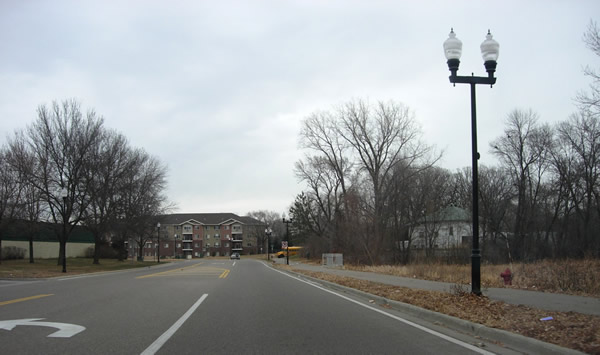
Looking northeast on Cedar Grove Parkway. The old Cedarvale mall can just
be seen on the left. Also note the new town homes on the right. Cedar Grove
Parkway was recently reconstructed with a center island.
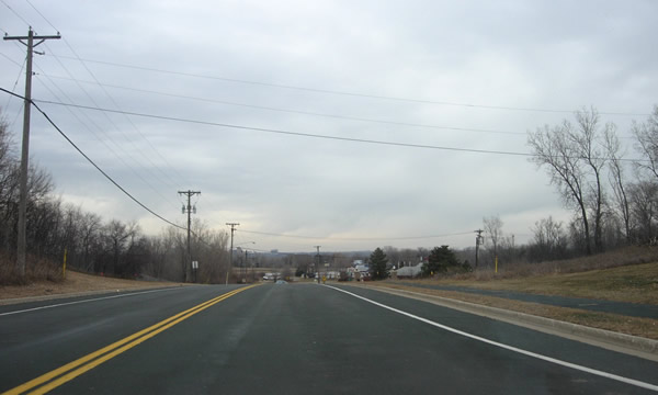
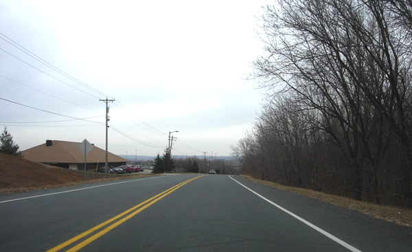
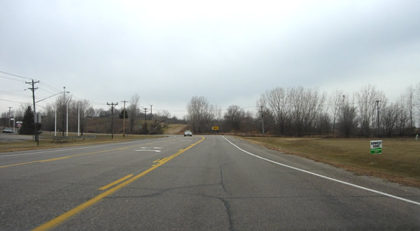
Looking northeast, just south of SIlver Bell Road. More new development can
be seen on the horizon. The Cedarvale Lanes are visible on the left.
Old Sibley Memorial Highway, Cedarvale Blvd - Bypassed in 1980
West of Cedar:
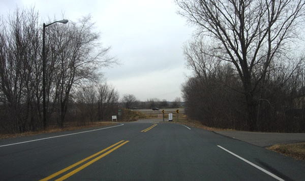
Above and below, looking northeast on Old Sibley Memorial Highway, west of Highway 77.
At the end of Old Sibley Memorial Highway, where it connects with Sibley Court.
The Cedar Avenue Freeway is visible just ahead.
East of Cedar:
Looking south down Nichols Road at Cedarvale Boulevard, just east of Highway
77. This was the site of the junction of Highway 13 with what was then known
as Cedar Avenue from 1948 until 1980. In about 1957, State Highway 36's route
was extended south to this location. In about 1978, it was redesignated Highway
77. Shortly thereafter, the intersection was disrupted by the construction
of the Cedar Avenue Freeway. The small brown sign still labels this part of
old Highway 13 as the Sibley Memorial Highway.
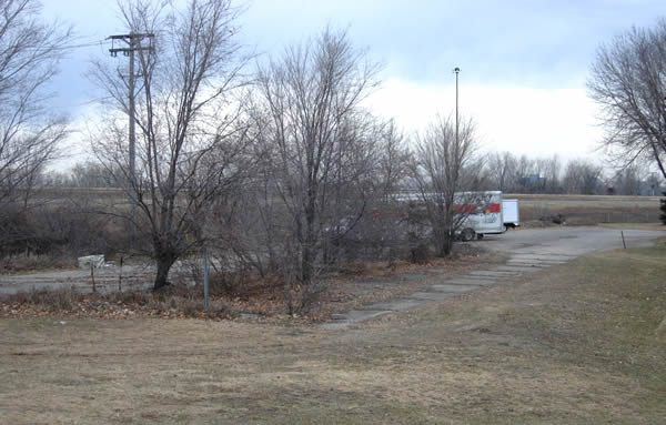
Looking north from about the same spot. Although the intersection with the
old northern part of Cedar Avenue is gone, a small portion of the old road
has survived as part of a U-HAUL rental lot. Modern Highway 13 runs across
the background.
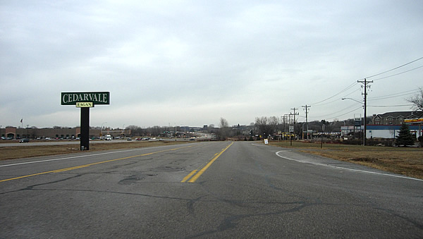
Looking southwest down Cedarvale Boulevard towards the old junction
with Highway 36 (at the curve). The road once continued straight ahead through
where the Cedar Avenue Freeway now runs.
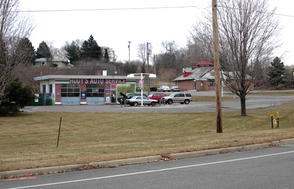
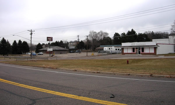
Businesses, defunct and otherwise on old Highway 13 near the Cedarvale Mall. (above and below). The local business owners are currently fighting eminent domain procedures that will seize their land to make way for a redevelopment project.
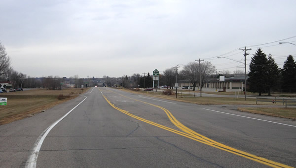
Looking northeast down Cedarvale Boulevard. The less than bustling Cedarvale
Mall is visible on the right (this picture was taken near rush hour on a weekday!)
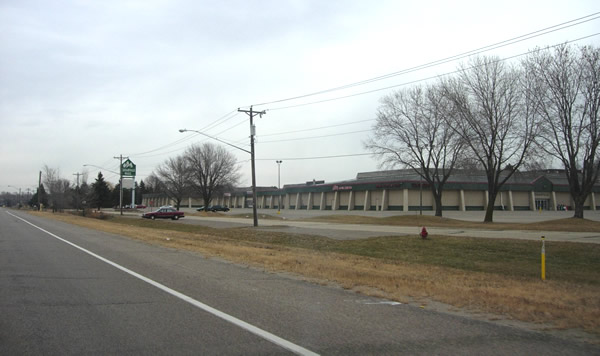
A closer view of the Cedarvale Mall, not long for this world.
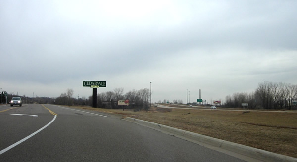
Looking northeast on Cedarvale Boulevard. Modern Highway 13 is visible on
the left. Cedarvale Boulevard once continued straight ahead, merging with
the modern highway's alignment just past the McDonalds on Silver Bell Road.
Looking southwest on Cedarvale Blvd. Here you can see one of the reasons the
Cedarvale Mall has failed: no direct connection to modern Highway 13 (the
lit sign hasn't helped much either). Note the change in pavement on the left,
marking where Cedarvale Blvd has recently been reconstructed.
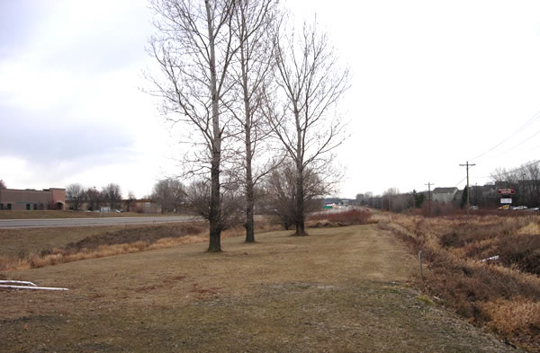
Looking northwest, just west of the McDonalds parking lot. This may be a portion
of Highway 13's old grade.