Mouse Over to See Reverse Side

|
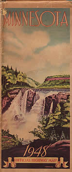
Stats:
- Size: 38" x 32" unfolded, 4"
x 9" folded.
- Scale: 1 inch = 12 miles
- Conditions as of: January 1, 1948
- Commissioner of Highways: M.J. Hoffmann.
Comments:
- The biggest change on the 1948 map was the update of the Twin Cities
and Duluth insets to the same format introduced in 1946 for towns
over 10,000 people. The new style insets were
also moved to the back of the map and enlarged to rather epic proportions. This format of Twin Cities and Duluth insets was only used between 1948 and 1950. The size of the insets varied greatly from year to year.
- The map key was moved to the back cover of the map from its
usual position in the upper right corner.
- State forests, shaded in green, were added to the map. Symbols for lookout
towers were also added.
|